
Guide
Peyto Lake: Hike Time, Best Time & Viewpoint
The Peyto Lake Viewpoint walk is 0.6 km each way and about 30 minutes round trip. Plan 45-60 minutes; compare the main lookout, Bow Summit hike and best time.
Save it for later on this device or print a clean planning copy.
Quick facts
- Best time
- July-September for the most reliable turquoise lake colour and easier trail conditions, Late June only after checking Parks Canada trail conditions for snow and ice, Winter or spring only with daylight, winter tires, road-condition checks and conservative expectations
- Recommended duration
- 45-90 minutes for the main lookout, 2.5-3 hours if you add Bow Summit Viewpoint
- Budget range
- Low: Park admission only, plus fuel and snacks · Mid: 120-220 CAD/day if Peyto is part of a full Lake Louise to Jasper drive · Comfort: 350+ CAD/day with lodging, slow dining stops or guided Parkway activities
- With kids
- Yes
Quick decision
Main Peyto Lake Lookout or Bow Summit?
Choose the main lookout for the classic Peyto Lake view in 45-60 minutes. Add Bow Summit only when visibility, trail conditions and your Parkway schedule support a 2.5-3 hour hiking block.
| Criteria | Main lookout | Bow Summit viewpoint |
|---|---|---|
| Walk and time | 0.6 km each way; plan 45-60 minutes for the complete stop | 3 km each way with 310 m gain; allow about 2.5-3 hours |
| Best for | First visits, families and full Lake Louise-to-Jasper drive days | Clear-weather days when Peyto is one of the route's main activities |
| Main trade-off | Busier, but the highest-value view for the least time | Quieter and broader, but it forces you to remove another Parkway stop |
Orientation
Why Peyto Lake is worth a deliberate stop
The Peyto Lake Viewpoint hike is short: Parks Canada lists the main lookout as 0.6 km each way with an estimated 30-minute round trip. Most visitors should still allow 45-60 minutes for parking, the walk and time at the view.
The mistake is assuming that short means friction-free. The parking lot can feel busy, the weather can hide the lake, and early summer conditions on the Icefields Parkway can still include snow and ice.
The best version is simple: arrive before the busiest part of the day, walk to the main platform, take your time at the view, and only add Bow Summit if the day still feels calm.

I would put Peyto early in a Lake Louise to Jasper day, not in the tired middle of the route. It is too strong to rush and too short to turn into a complicated plan. Give it one clean window, then keep moving north.
Alex Travels · TravelHighlights.io
Keep planning
Choose the next useful step
Jump straight to the next relevant part of your trip.
Guide map
- Peyto Lake Parking Lot / Bow Summit
- Peyto Lake Lookout
- Bow Summit Viewpoint
- Bow Lake
- Mistaya Canyon
Highlights
Top highlights
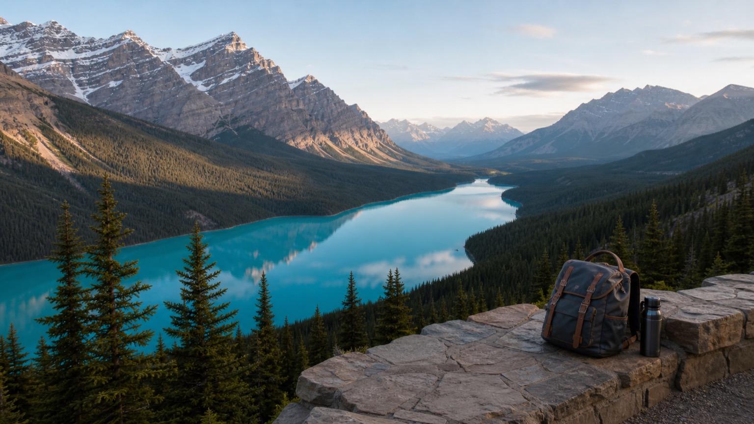
Peyto Lake Lookout
The main elevated platform above Peyto Lake. Short, high-reward and the right choice for most first-time visitors, families and full Parkway drive days.

Bow Summit Viewpoint
A longer add-on beyond the main lookout. Parks Canada lists it as 3 km one way with 310 m elevation gain and about 2.5 hours round trip.
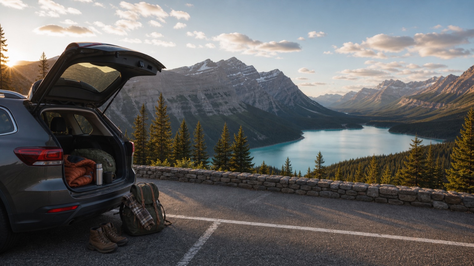
Early morning timing
Best if Peyto is a priority stop. Start from Lake Louise with fuel and layers, visit Peyto before late-morning crowd pressure, then continue north.

Icefields Parkway fit
Peyto works best with Bow Lake and Mistaya Canyon, not as one of too many rushed scenic pullouts on a Lake Louise to Jasper transfer.
Itinerary
Suggested itinerary
45-60 minute Peyto stop
Best for most visitors and full Parkway drive days.
- 1Park at Bow Summit / Peyto Lake parking lot.
- 2Walk to the main Peyto Lake Lookout.
- 3Spend real time at the platform, then continue to Mistaya Canyon or the glacier section.
2.5-3 hour Bow Summit add-on
Best if the trail is dry enough and Peyto is one of your main stops.
- 1Start with the main Peyto Lake Lookout.
- 2Continue toward Bow Summit Viewpoint only if visibility, footwear, time and energy are good.
- 3Cut another Parkway stop later in the day instead of rushing the rest of the route.
Conservative shoulder-season plan
Best when June snow, autumn weather or winter road conditions are uncertain.
- 1Check Parks Canada trail conditions and Alberta 511 before leaving Lake Louise.
- 2Bring traction or turn around if the path is icy and you are not equipped.
- 3Keep Peyto as optional if visibility is poor or the Parkway requires slower driving.
Bases
Best base areas
Best for
Lake Louise
Early Peyto Lake starts and south-to-north Parkway drives
Pros
- Closest practical base for a calm morning at Peyto
- Easy to pair with Bow Lake, Mistaya Canyon and a Jasper transfer
- Lets you fuel and start before the day gets crowded
Watch-outs
- Lodging is expensive and limited
- Early starts still matter in peak summer
Best for
Banff
Travelers who want more services and do Peyto as a longer day trip
Pros
- More lodging and food options
- Works if Peyto is combined with Lake Louise or Bow Lake
- Easier fallback options if weather turns
Watch-outs
- Longer drive to Bow Summit
- More tempting to overpack the day
Best for
Jasper or Icefields Parkway lodging
Northbound or two-day Parkway plans
Pros
- Helps split the drive if you do not want one long transfer day
- Better for adding Bow Summit or glacier-area stops
- Keeps the route from feeling like a checklist
Watch-outs
- Services are limited along the Parkway
- Road-condition planning matters more
Planning notes
Avoid These Common Mistakes
Confusing the lookout with the lake-shore trail
The main lookout is short and easy. Parks Canada lists the actual Peyto Lake trail down toward the shore as steep, rough and suitable for experienced hikers only.
Arriving at peak crowd time on a rushed drive day
Late morning and midday can feel compressed in summer. If Peyto matters, place it early after Bow Lake rather than squeezing it between too many pullouts.
Ignoring early-season ice
The Icefields Parkway sits high. Parks Canada trail reports can still show snow, ice and cleat recommendations in June. Check conditions before assuming a dry paved stroll.
Adding Bow Summit without removing another stop
Bow Summit is not just "five more minutes." It changes Peyto from a viewpoint stop into a real hiking block.
Expecting perfect colour in bad visibility
Peyto's colour is best when the lake is thawed and light reaches the water. Cloud, smoke, snow or rain can flatten the view dramatically.
Travel planning answers
Frequently asked questions about Peyto Lake
How long is the walk to Peyto Lake Lookout?+
Parks Canada lists Peyto Lake Lookout as 0.6 km one way with 30 m elevation gain and about 30 minutes round trip. Many travelers still plan 45-60 minutes so the stop does not feel rushed.
Is Peyto Lake worth stopping for?+
Yes, if visibility is reasonable. It is one of the strongest short scenic stops on the Icefields Parkway, especially on a Lake Louise to Jasper drive.
When is the best time of day for Peyto Lake?+
Early morning is usually best for a calmer visit, especially in July and August. Late afternoon can also work if you are returning south and still have daylight.
Should I hike to Bow Summit Viewpoint?+
Add Bow Summit only if you have 2.5-3 hours, suitable trail conditions and enough energy. For most first visits, the main Peyto Lake Lookout is enough.
Is Peyto Lake good with kids?+
The main lookout can work well with kids because the payoff is quick. Keep everyone on designated paths and skip icy, rough or longer trails if conditions are poor.
Do I need to check road conditions?+
Yes outside stable summer weather. The Icefields Parkway is a high mountain road with limited services, winter tire rules in season and possible weather-related closures.
Worth it / Skip if
Worth it
Peyto Lake is one of the highest-value short stops on the Icefields Parkway: a short walk, a dramatic elevated viewpoint and a lake shape that feels instantly recognizable.
Skip if
Skip or downrank it when visibility is poor, the trail is icy and you are not equipped, or your Parkway day is already overloaded with Bow Lake, Mistaya Canyon, Columbia Icefield and Jasper-side waterfalls.
With kids
Treat the main lookout as the family-friendly goal. Bring layers and grippy shoes, stay on the designated viewpoints and skip the longer Bow Summit add-on if energy is fading.
Budget range
Low
Park admission only, plus fuel and snacks
Mid
120-220 CAD/day if Peyto is part of a full Lake Louise to Jasper drive
Comfort
350+ CAD/day with lodging, slow dining stops or guided Parkway activities
Guide details
Peyto Lake Lookout: the main view
Quick answer: Parks Canada lists the Peyto Lake Viewpoint walk as 0.6 km each way, 30 m of elevation gain and about 30 minutes return. For most travelers, Peyto Lake Lookout is the right target, but a 45-60 minute total stop is more realistic once parking, the walk and time at the platform are included.
It starts from the Peyto Lake parking lot at Bow Summit, about 40 km north of the Lake Louise junction on Highway 93 North. Parks Canada lists the lookout trail as 0.6 km one way with about 30 m of elevation gain and an estimated 30-minute round trip.
That does not mean you should plan only 30 minutes. The view deserves a pause, the platform can be busy, and weather changes quickly at this elevation. A 45-60 minute block feels more realistic for a normal road-trip stop.
If you are travelling with kids, tired legs or a long Jasper transfer ahead, stop here and be done. You do not need the longer Bow Summit add-on for Peyto to feel worthwhile.
Bow Summit Viewpoint: when to add it
Bow Summit Viewpoint is the longer option beyond the main lookout.
Parks Canada lists it as 3 km one way with 310 m of elevation gain and an estimated 2.5 hours round trip. That turns Peyto from a quick scenic stop into a real hiking block.
Add it only when three things are true: the trail conditions are good, visibility is strong and your day has enough space. If you are driving all the way to Jasper, adding Bow Summit usually means dropping another stop later.
In June or after storms, be cautious. Parks Canada trail conditions for the Icefields Parkway area can still list snow, ice, slush or cleat recommendations around Peyto and Bow Summit.
Best time of day for Peyto Lake
If Peyto is one of your priority stops, go early.
From Lake Louise, a clean morning rhythm is fuel first, then Bow Lake, then Peyto Lake before the main crowd pressure builds. You can continue north toward Mistaya Canyon, Saskatchewan River Crossing and the Columbia Icefield area afterwards.
Late afternoon can also be good if you are returning south and have enough daylight. It may feel calmer than midday, but you need to stay realistic about the drive back, weather and animal activity near the road.
Midday is not a failure. Peyto is still beautiful. It just tends to feel more compressed, especially in July and August when the Icefields Parkway is part of many road-trip and tour routes.
Best season for colour and conditions
July through September is usually the safest planning window for the classic turquoise lake view.
Late June can be excellent, but it is not guaranteed. At Bow Summit elevation, snow and ice can linger even when lower-elevation Banff trails feel like summer. Parks Canada notes that prime hiking season in Banff runs July through mid-September and that many passes can remain snow-bound until late June.
September is often the best compromise: strong lake colour, cooler mornings, and usually less pressure than peak summer. The tradeoff is shorter daylight and faster weather changes.
Winter and spring are different trips. Peyto can be atmospheric, but road conditions, winter tires, avalanche closures, daylight and icy trails become more important than the photo.
How to fit Peyto into the Icefields Parkway
Peyto Lake works best as part of the Banff-side Parkway sequence, not as a detached checklist item.
A strong first-drive order is Lake Louise, Bow Lake, Peyto Lake, Mistaya Canyon, then the glacier section. That is already enough for a full travel day if you are continuing to Jasper.
If you start in Banff, Peyto becomes a longer out-and-back unless you combine it with Lake Louise, Bow Lake or a partial Icefields Parkway day. It is still worth it in good weather, but not if the day becomes mostly driving with no time to breathe.
If you are driving south from Jasper, place Peyto after the glacier section and before Bow Lake or Lake Louise. Do not save it for the point where everyone is already tired.
What to do in poor visibility
Peyto is a viewpoint-first stop. Visibility matters.
If clouds, smoke, heavy rain or fresh snow hide the lake, do not force the stop into a long wait unless the forecast is clearly improving. Walk to the platform if it is safe and easy, take the moodier view for what it is, then keep the day moving.
In poor conditions, Bow Lake can sometimes feel more satisfying because it is closer to the road and less dependent on an elevated panorama.
With kids and mixed fitness
Peyto Lake is one of the better high-reward stops for families if you keep the plan simple.
The main lookout gives a big view quickly. Bring layers, snacks and footwear that can handle wet or icy patches. Keep children on the path and viewing platform; the alpine terrain is fragile and edges can be dangerous.
Skip the lake-shore trail with kids unless your group is experienced and conditions are clearly suitable. Parks Canada describes the trail down from Peyto Lookout toward the lake as steep, rough and for experienced hikers only.
Final verdict
Peyto Lake is worth it when you give it a clean role in the day.
For most travelers, that means an early 45-60 minute stop at the main lookout during a Lake Louise to Jasper drive. Add Bow Summit only if conditions, timing and energy make it feel calm rather than forced.
It is not a place that needs a complicated plan. It just needs the right window.
Continue with the Icefields Parkway guide and the Lake Louise Viewpoints guide, or return to West Canada Highlights for the full route.
Sources & Last updated
Last updated: 2026-08-31
Sources
- Parks Canada Banff hiking: Peyto Lake Lookout distance, Bow Summit Viewpoint distance, trailhead and seasonal hiking safety(checked: 2026-08-15)
- Parks Canada Banff trail conditions: Current Icefields Parkway area trail condition updates, snow, ice and closure checks(checked: 2026-08-15)
- Parks Canada Icefields Parkway winter maintenance: Daylight driving, road-condition checks, winter tires and limited services along Highway 93 North(checked: 2026-08-15)
- Parks Canada driving rules: Official winter-tire requirements and Alberta road-condition links for Highway 93 North(checked: 2026-08-15)
For your trip planning
Travel Services
Useful services for your trip. Choose what fits your plans.
Affiliate offers: We may earn a commission if you book. External search forms load only when opened, sharing data with Travelpayouts and the provider.
Nearby / next stop

MS · LOG
Last updated 2026-09-07
Icefields Parkway Guide: Best Stops Between Banff and Jasper
232 km from Lake Louise to Jasper: five stops, a separate Parker Ridge hiking day, and decisions on fuel, overnight stays and mountain weather.
Read guide →
MS · ITIN
Essential
Last updated 2026-09-07
Banff National Park Guide: Highlights + 3-Day Route
Banff in 2–4 days: prioritize hot springs, valley views and mountain lakes, choose a base, and plan parking and shuttles before arriving.
Read guide →